The ‘New Forest 80’ is our first challenge route. As the name suggests, it’s an 80k (just a little over actually) route to complete within 24 hours. If you’re fit and a good navigator a sub 20 hour time should be a shoe in.
Now, most organised challenge walks seem to come in at 100k but at Sport Walk, we think 80 could be the magic number, as it allows whippets to scorch round in a high teens time, while normal souls can still do it comfortably within the limit.
Sport Walk’s founder Roger Burlinson was the guinea pig for the first ever completion of our route, having been heavily involved in plotting and testing it. Roger is a keen solo sport walker and likes to cover ground at a good pace, so his performance would be a good indicator of the undertaking for many fit walkers.
At over 80km in total distance (about 50 miles), the estimated moving time to complete the route was between 17 & 18 hours, at 5kmh or roughly 3mph. Add to this rest stops, breaks to take photos or to buy food along the way and Roger’s 20 hour target was looking pretty reasonable.
The route takes in some of the best, most beautiful parts of the forest for walkers, staying largely clear of the tourist hotspots. The main exceptions to this rule are just the strategically important checkpoints of Brockenhurst and Picket Post Services. We say ‘checkpoints’ but they are really just places included in the route to enable self sufficient walkers or groups to buy food and drink along the way or to allow for supported walkers to connect with their helpers. These points can also be used to abandon the walk if needed or, indeed, be end points for anyone wanting to just tackle a section of the whole walk.
The walk traverses the National Park from south east to north west and is best followed in this direction given that the nature of the route at the end is better suited to being tackled at night. The start point is Calshot Castle, which sits right next to Calshot Activity Centre, one of the leading outdoors centres in Hampshire. The finish is the middle of Fordingbridge bridge, across the River Avon, north of Ringwood.

The iconic start point, right next to the beach might come as a surprise to some but the New Forest National Park includes a substantial chunk of Solent coastline and the walk’s start is at the most south easterly tip of the entire park.
Roger set off at 7am and quickly settled into his pace. Efforts to stick to his 5kph target tempo proved futile, so he just went with his normal 6-6.5kph speed and hoped he’d last. This walk was not just a first completion attempt, it was also an opportunity for Roger to fine tune the equipment needed for a self sufficient transit.
As this was an unsupported solo walk, he carried a 10kg pack which held a number of options, some of which proved unnecessary, such as a sleep mat & bothy bag. Also, his current kit spec isn’t fully lightweight, so he could have had a much lighter load to carry. In fact he later identified around 21 items that he could save weight on, either by leaving them out of his kit or by buying lighter versions.
The Early Miles
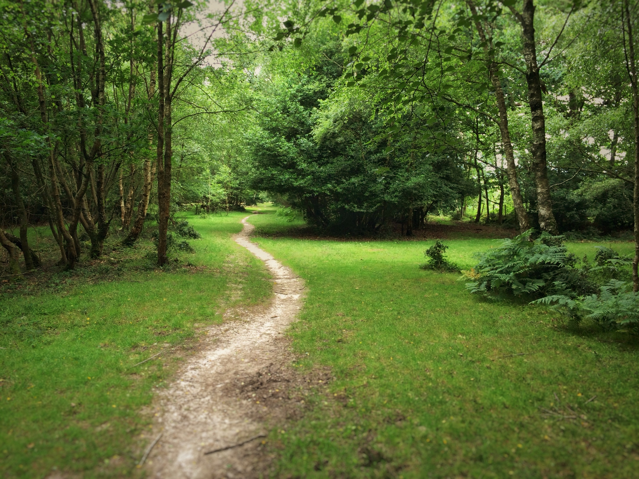
The first stage traversed up from Calshot along footpaths and some heathland, through the village of Langley until breaking out onto the first section of what most people would recognise as New Forest heathland. These early miles reveal a little more of the character of the coastal parts of the National Park, which are largely agricultural and wholly different in appearance to the typical New Forest views.


From Langley, the route crosses over to the upper stretches of the Beaulieu River, which is one of the hidden treasures of the forest. For anyone not seeking a fast time, a little exploration around the bridge over the river near Kings Hat is well worth it. For those pressing on, as Roger was, then it’s straight over one of the forest’s large wild lawns and on to the endearingly named ‘Pig Bush’.

The trail snakes down from Pig Bush through a typical forest bog (probably the New Forest’s only natural hazards, although through this one, the gravel path is well protected) and into one of the many large plantations, this one transporting you down to Balmer Lawn and the edge of Brockenhurst.
Roger had prepared his water supply to carry him from Calshot to Brockenhurst, roughly a five or six hour section and once in Brockenhurst he stocked up on fresh water for the bladder in his rucksack, as well as an extra bottle to drop an ‘electrolyte’ tablet into, to keep his mineral balance in check.
There are two major supermarket brands in ‘Brock’, each with a convenience store, so the options for buying lunch and snacks are excellent. There are also small sandwich shops and bakeries too, for those who’d rather support local traders or have something a little more special.
Roger used the Brockenhurst stop to take on a snack, lunch for that day and drink to last until Picket Post, the next major check point. He arrived shortly after 12 noon and then managed to walk on further into the woods north west of the village before stopping for lunch at a shady bench next to ‘Highland Water’ – one of the many irrigation streams that feed the plantations.
After stopping for about twenty minutes to half an hour Roger pressed on. The route from here crossed over to the iconic Rhinefield Ornamental Drive, one of the few natural visitor attractions that the walk actually includes. Here, just as at Brockenhurst, there are toilets and the car park also offers up the potential to off load any wrappers or other waste left over from lunch in the litter bins.

From Rhinefield, the route serves up the first climb of the walk, a short but quite steep run up to Holm Hill and from there, maintaining the high ground onto the edge of Wilverley Plain.

After Wilverley comes one of the most beautiful little valleys in the whole forest – Horseshoe Bottom, which is crossed at the head giving a wonderful view right down the grassy slopes. From there it’s into Wilverley Enclosure and an undulating woodland track which dumps you out opposite Holmsley Team Rooms.
Those with a weakness for scones and cream teas beware! Holmsley makes some of the biggest, tastiest scones we’ve come across but then again, if you want to take your time and make more of a trip of it, then go ahead! You won’t regret it! Actually, you might a bit later on but you can make that call.
At Holmsley the route briefly joins the old Brockenhurst to Ringwood railway line, closed during the Beeching cuts and now a popular walking and cycle trail. At the ruin of an old bridge, we ‘alight’ and head left up onto Holmsley Ridge before dropping down a steep chute to Whitten Pond. You might have to plot a course through all the horses and cows that hang out at this, the animal version of Holmsley Tea Rooms but the view of the ponds from the high ground above is well worth it.
The route then enters the penultimate segment before Picket Post, a stunning quiet path that traverses south and west of the village of Burley. The heathland vistas along this stretch are divine and then, once you’ve crossed the road at the end and started up the steep hill which takes you up to the Smugglers Road at Vales Moor, you can look back and see the heath from a different perspective. Still just as divine!

Pressing on along the Smugglers Road, you can see and hear the A31 in the distance and the second checkpoint. For anyone abandoning (at around 52km there’s no shame in that) or meeting up with a support crew, the car park at the end of the track is the place to meet. If you’re travelling alone like Roger, then the eastbound services will be your target but reaching them is a little tricky.
At the services, you can choose between garage forecourt food – sandwiches, pies etc or, like Roger, you might fancy visiting a certain fast food outlet with a big yellow M! At this stage in the trek there is something to be said for taking on a load of calories but it’s more about the psychological benefit of indulging in something hot.
Once done with the services, it’s back onto the trail. This next phase of the walk takes you towards dusk (assuming you’re doing it mid summer and moving at a fair pace) and also brings you to more undulating terrain. The steep road out of Linford is a slog but the reward is Red Shoot Plain.
From there, it’s back over Rockford Common and down to Moyles Court School, where the path then cuts very steeply up onto Ibsley Common.


This quiet, wild, beautiful heathland ridge offers fabulous views all around, before you drop down and onto the way marked cycle track at Linwood (not to be confused with Linford). From here, the whole remaining route follows way marked cycle tracks and then, finally roads out to Fordingbridge.
Climbing up the track out of the Linwood section, you pass the High Corner Inn, which at this stage appears rather like a mirage in front of you, oozing the scent of beer and pub grub (very un-helpful), you touch the road at the top briefly and then immediately head back towards Broomy Lodge and the penultimate stretch.
Dropping down the track through Broomy Inclosure to Holly Hatch Cottage you arrive at another idyllic quiet valley, then the trail rises steeply up to Fritham Plain and the last major junction at Fritham, where a sharp left sets you up for the last forest section.
By this time Roger was in complete darkness and fired up his head torch, as it was only a few days after a new moon. The next stretch was all on woodland tracks and with a rapidly deteriorating knee and a firm arrival time to aim for, Roger decided to go Nordic, calling on his walking poles for a little extra support.
A while into the woodland section, the track suddenly shot skyward and the climb up to Hampton Ridge began. The effort required to make good speed up the hill is eased by the knowledge that once on top of Hampton Ridge, the rest of the route is flat or downhill, apart from a short climb on road into Frogham village.
Hampton Ridge seemed to continue forever for Roger, without sight to get a measure of his position in relation to the forest edge. The only thing to do was to zone out, focus on the illuminated blob of track in front and concentrate on settling into some sort of rhythm with the poles. Finally the track suddenly drops down and this signifies the nearing of the end of the track.
At Frogham, the route down to Fordingbridge is straightforward. Turn left onto the road and just keep walking until you reach the T junction after about two miles. Roger reached his pickup rendezvous almost exactly at midnight and then just dragged himself the 200 metres or so into town and the bridge itself.
Roger was pleased with his time – about 17 hours in total but he felt there was a lot he could do to make the journey easier (in terms of the kit he was carrying) and therefore faster. Reducing the ‘down time’ for meals and to buy food etc was a tricky question because one of the best things about this walk was going fully un-supported, so it’s inevitable that you need to allocate a little time to buy food and then also a little time to eat it and have a short recovery break.
By the time Roger reached Fordingbridge, his legs were seriously tight but still working OK and his speed at the point where his watch unfortunately dropped the satellite and therefore stopped tracking his walk – 78km – was still around 6kph, the same as at the start. He was suffering some pain in one leg under the knee whenever he hit an incline from about 60km onwards and had also started to feel some soreness in his legs from about a third of the way in. He realised early on that he was far from ready for the walk, contrary to the way he felt beforehand but just needed to see what was possible.
So, mission accomplished for the first completion. Roger may have felt he could have gone lighter and therefore a little faster or at least be less depleted by the end but around 17 hours for 83k isn’t bad!
The Sport Walk New Forest 80 is a corker for a lowland trail. The 24 hour target is certainly achievable for anyone with reasonable fitness, the views and landscape are just divine and the last third offers quite a test, with more rolling terrain than the early miles. We’ll be posting a link to the route on OS Maps soon, so go do it, it’ll make you see the New Forest in a very different light.
Roger’s data is on Strava for anyone who wants to check it out:
Roger’s walk stats:
Start – Calshot Castle 7am
Brockenhurst Checkpoint – 12:30pm
Picket Post checkpoint – 5:40pm
Finish – Fordingbridge – 12 midnight
Total time – 17:01
Walking time – 13:55
Average speed – 5.6kmh
Average pace – 10:40/km
Total distance (including a few wrong turns!) – 83.76km
Roger’s kit list key items:
Lightweight trousers, Skins calf guards, short sleeved base layer, lightweight running gilet, La Sportiva Boulder X shoes.
Osprey Mutant 38

Black Diamond walking poles
Sleep mat
Bothy bag
Waterproofs – cag & over trousers
Micro fleece
Silva head torch
Spare torch (high powered rechargeable MTB light)
Spare socks
Spare base layer
Salomon lightweight wind cheater
Emergency safety blanket
Multi tool
Smart phone with OS Maps app
Backup OS ‘hard’ map
Leave a Reply