One of the problems with an Ultra route is that inevitably the section at the end will come after dark, unless of course you start in the dark, in which case the bit at the beginning will be in the dark – you just can’t win!
And so it was for the ‘Sport Walk New Forest 80’, our first Ultra route – starting out on a network of paths and tracks by the Solent (done in daylight to simplify route finding on the ground) and ending on the simple to navigate Fritham to Frogham bike trail (easier to route find in the dark). The problem is, this whole section of the New Forest, north of the A31, has arguably the most beautiful ‘wild lands’ of the whole forest.
Many of the hub attractions for tourists lie to the south – the main visitor towns, lawns manicured to within a millimetre of existence by the ponies, the picture postcard streams, the ornamental drives, Beaulieu, Lyndhurst… we could go on. As lovely as all these are, they are… how should we put it… not very wild. The lands to the north of the A31 are much better! Yes, they too have their picture postcard hubs, towns and ‘pretty’ spots but they also have what we like to call the ‘New Forest Massif’. A collection of broad flat ridges, small hills and generally undulating ground, such as Hampton Ridge, Godshill Ridge and Ibsley Common. If you love huge expanses of heath or moorland more than you love woodland and grassy valleys, then the north of the forest is without question, the jewel in the crown.
Given that the New Forest 80 hits this part of the National Park in late afternoon and runs through dusk into night as you reach the bit with some of the best views, we thought we’d create a little 25k loop that includes the very best parts, so you can also enjoy the treasures on offer up there (without having to do the NF80 in reverse to get a daylight run). Oh, and it’s also a great training loop!
We start outside Moyles Court school but you can pick an alternative start point anywhere else on the loop.
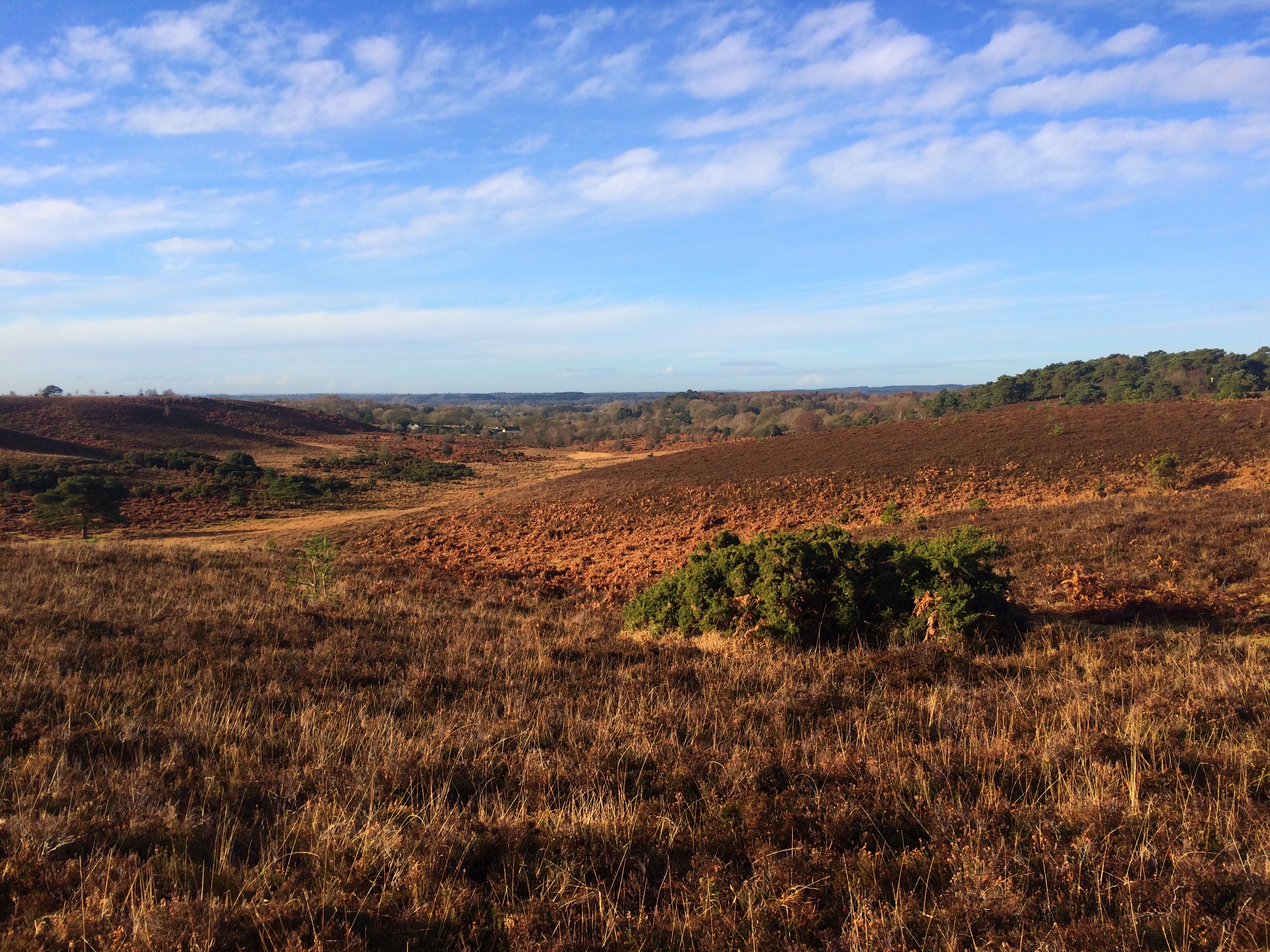
From Moyles Court the route heads straight up onto Ibsley Common which spreads out in front of you and gives views across to Hampton Ridge in the north and back down to Rockford Common. From Ibsley Common, the route heads up to Dorridge Hill and on the way you pass an old WW2 air raid shelter from a war time observation point.

As you approach the valley that leads to Dorridge Hill and crest the lip of the ridge you’re on, a magnificent view of Hampton Ridge, your next target, reveals itself. From Dorridge Hill, you descend steeply down to Ogdens and what can be a really muddy section past the farm but it’s relatively short lived and soon you’re climbing again, up to Abbotswell at Frogham and the start of the track along Hampton Ridge.

This is one of the forest’s designated cycle routes and the gravel track will give you really good going all the way to Fritham at the other end of the ridge. It’s hard to over state how glorious the view can be from Hampton Ridge on a fine day. The run along it is easy and you can make good time. As you hit the woodland at Amberwood Inclosure, you suddenly lose height and the track drops steeply before winding through the trees and then popping out the other side with a climb up to Fritham.

There’s a good pub at Fritham but we won’t go into that (distractions etc). A sharp right turn through the Fritham car park kicks you out onto Fritham Plain, another fine piece of high ground although without the achingly gorgeous views of Hampton Ridge. Straight along the top you go and then you drop down again to the wonderfully picturesque spot where Holly Hatch Cottage sits next to a pretty stream. It feels isolated and quiet but don’t linger, remember this is a Sport Walk!
From Holly Hatch, it’s back up again (you getting the picture?) to Broomy Plain and then back down again past High Corner Inn (yes another good pub… resist, resist) to follow the track at the bottom of the valley next to Ibsley Common (your start ridge) to the next pub (no you can’t) – the Red Shoot Inn. A few paces along the road and then it’s left into the woodlands of Appleslade Inclosure and up onto Red Shoot Plain, the last high ground of the walk.
Crossing Rockford Common and then skirting round old workings that are now just a huge broad depression in the land leads you towards the end of the walk – a short ramp down past the car park and across Dockens Water (there’s a ford or a footbridge, you choose) to your start point opposite Moyles Court School.
It’s a walk that gives you some of the best views of New Forest heathland and the undulating landscape and ridges that define this northern part of the park. If you only walk one route in the New Forest walk this one, it’s the best portrait of the National Park you’ll see.
View the route or download it to take on your Sport Walk at OS Maps
Leave a Reply